
This is explained in particular by the higher performance of the most dynamic RIPs, since between the start of 2018, the top 3 RIPs went from an average of 12.5k lines per quarter to more than 28.5k connections per quarter in the second quarter of 2019. The 40k connections per quarter mark has been crossed and exceeded for 2 quarters by the Cap Fibre delegate of the SMO La Fibre Numérique 59/62 after having been brushed against by Rosace Fibre (Grand Est Region in the former Alsace region).
T3 2017
T2 2019
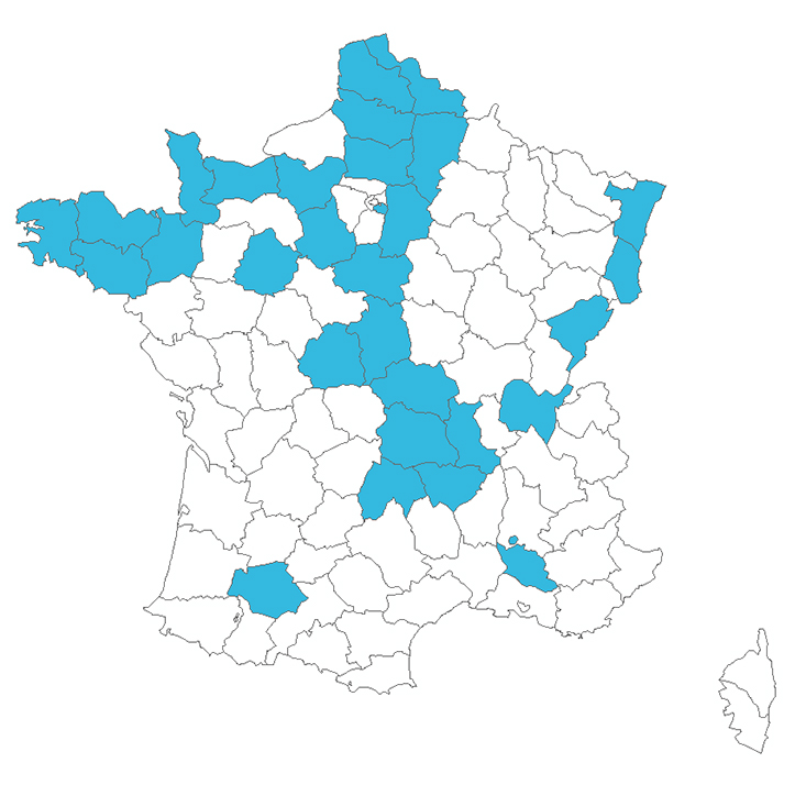
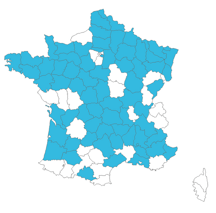
NB: The maps only show the departments concerned by RIPs since some RIPs are involved in infra-departmental territories such as the Pays de Bitche, Vannes Agglomeration, the Plateau de Saclay, or the commune of Gravelines for example.

It should be noted that some departments will soon see their deployments come to an end, as is the case in Oise and Loire, and will therefore no longer be able to provide their strong dynamics... but will allow a redistribution of resources to other territories.

Finally, we are also taking advantage of the AVICCA TRIP to update our mapping of the archipelagos with also a first animated version showing the appearance of new archipelagos since Q2 2018... but the ocean of zones to be deployed in FttH remains immense... in RIP zone, in AMII/AMEL zone, and in ZTD.
405k lignes FttH sur les RIP d'après l'@Arcep au T3 2020. Encore 1 trimestre exceptionnel pour le #1 @THD5962 qui bat le record pour un RIP sur 1 trimestre avec ~50k lignes. Sur le podium pour la 1ère fois @girondehautmega , @lafibreenalsace habitué du podium occupe la 3ème place pic.twitter.com/qI228V37LV
— @tactis (@TACTIS_group) December 11, 2020

Benjamin Fradelle

FTTH Archipelagos Map
Tactis Mapping
FTTH Archipelagos Map
To access the FTTH archipelago map data, please fill in your details in the form below:
